Day
6
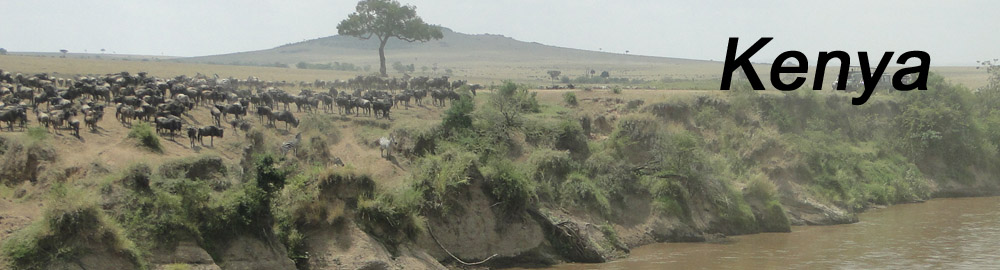
(September 15, 2013) Thomson's Falls and route to Maasai Mara
Before
We will leave the hotel as soon as
possible
as this is the day with more kilometers to cover. The plan is go to
Lake Bogoria, enjoying its beautiful views with millions of flamingos
and a geothermal area with geysers and boiling mud.
We cannot be there after noon because, as Cinderella, we must leave the
place before 12 PM in order of being able of reaching our cap in Maasai
Mara before night, as this is a route can be over 5 hours and a half.
After
While in breakfast we’re told there is a road that
allows
reaching Lake Bogoria and they’re doing tours usually to there.
Somehow, we are already resigned to miss Lake Bogoria because, although
people can get there, we already learnt what can do with us a road in a
bad condition. We will have a rough road in our last stage of our drive
to Maasai Mara and we want to avoid the night can get us in that road.
We are also removing kilometers from today’s long route. With this
change in the plan we’ve rested and got the breakfast later, visiting
the falls and spending the rest of the day on reaching our room in
Maasai Mara, the last before the relaxing days in the beach.
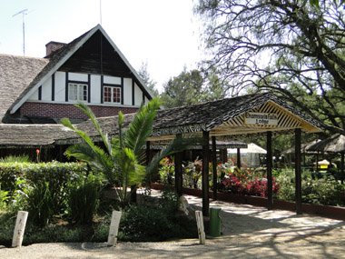
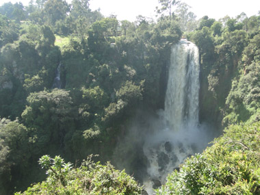
From the hotel’s entrance one can hear the roar of the falls,
which makes really easy going to the right place. It is a very short
walk where you must pass by the only part opened in the fence around
the space with the view point and the way to go down.
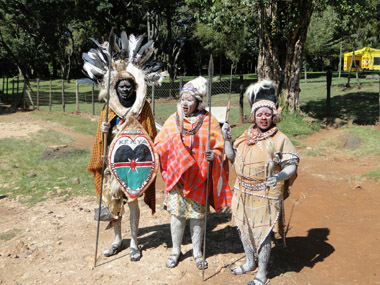
It seems we haven’t come by the usual entrance, as we can see that at
our right, with a lot of stalls selling souvenirs and people offering
some touristic attraction in exchange of some shillings. The first of
those coming to us are a man with two women dressed and painted as
typical Kikuyu tribe. We make some pictures with them. Then appears a
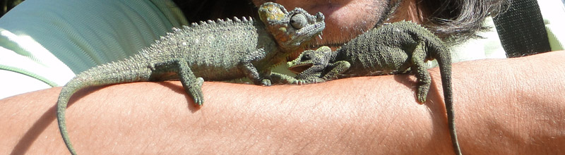
man with a couple of chameleons we can have climbing by our body. As I
have three 200 ksh bills, I give two of them to the Kikuyu to keep the
other one for the chameleons’ man. They answer me there are three of
them and I just ask them to share the money. But the chameleons’ man
has the rate writing in his arm, and it is 400 ksh, so I must change
anyway.
Then is the woman for the admission tickets who
comes
to us, as we must pay 200 ksh for them. When we see the sellers are
coming for us too we go to the view point downstairs, lonelier and
smaller, for some pictures before leaving the place.
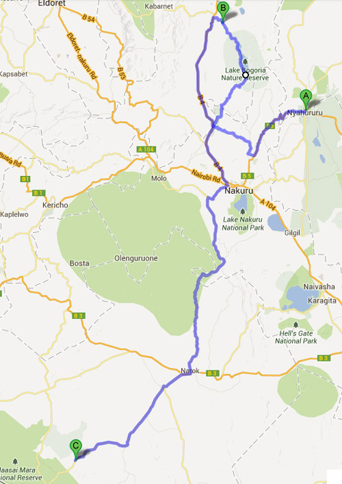
With this, we take the car around 10 AM for taking B5 to Nakuru
following the itinerary showed in the map above, but without taking the
road north to the lake. This road has parts quite worn down, with
several potholes, and some other in works, making the drive slower. We
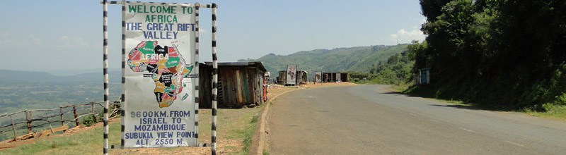
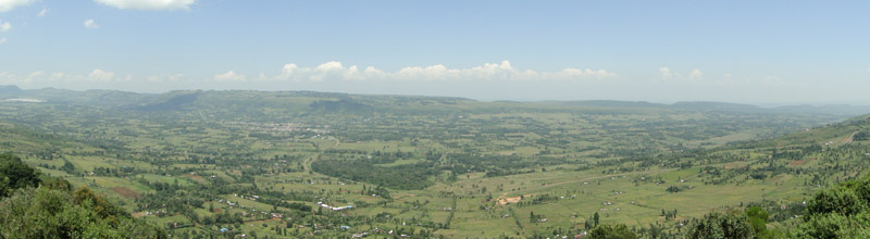
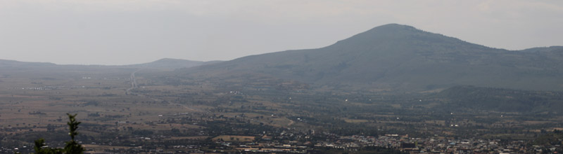
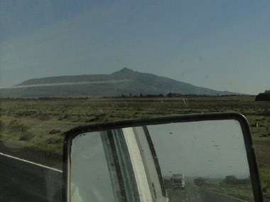
stop in Subukia view point for our first views of Rift Valley from
high: a vast flat land some hundreds of meters below us which is part
of this huge scar in our planet. This valley is more important than
looking as wanting to split Africa in two pieces, as here is where the
oldest human rest have been found, including the famous Lucy.
This road offers a gentle driving through the
rural
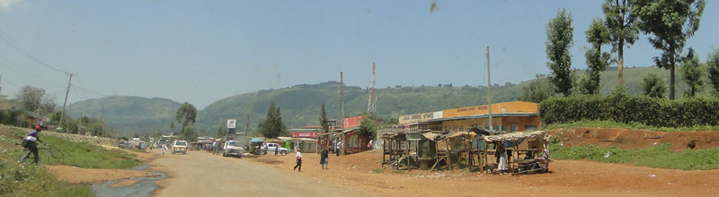
area, where villages are appearing every when and then, but we always
can see people walking along the road. The most of them are well
dressed and seems as not matching with the place. We assume this can be
because today is Sunday.
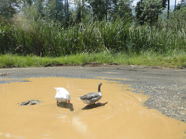
Somehow, the road itself, keeps the standard for
these sort of areas of the country, with parts completely worn out and
animals crossing at their will. Even we pass by a spot where all the
tarmac part is occupied by a big pothole full of dark water and two
ducks are swimming on it as cars are forced to avoid it by the sides.
Reaching Nakuru is quite simple taking motorway
A-104, the one heading to Nairobi. We know it because we took it to go
to Naivasha. We must drive all to South for, 30 Kms before Nairobi,
taking the exit going down to Rift Valley and heading to Narok. But
that exit is at right and there is none in our direction, so we must go
on for a while until finding a place to turn out. Then we can come back
to the exit, by the side full of souvenirs shops around viewpoints
looking to the Valley. It is in the gas station just before the exit
where we stop to fill fuel and lunch from our packed meal we’re
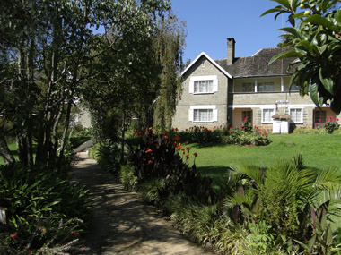
bringing from Thomson’s Falls Lodge.
It looks like today is not finally be such a
complicated journey as I advanced: as we’re going down to the valley, a
sign points Narok to 100 Kms, if the road keeps being this good we can
be there by 4 PM and, from Narok, I’ve read everywhere it is a 2 hours
ride to Maasai Mara.
And that’s what I’m thinking until I see Lake
Naivasha. I can believe neither my eyes nor the GPS. It cannot be. I
stop in a hotel to confirm it really is. They explain to us by this
good road we’ve been able of reaching, Lake Naivasha in less than 30
minutes, while it has taken almost 2 hours by the Nakuru motorway. So,
a road showed in the map as secondary is a lot better than the main
motorway in this case. This is another example of the importance of
knowing well the roads in this country. The thing is we’ve got the
wrong way because at Mai Mahiu, the town just down in the valley, we’ve
gone on to the Old Naivasha road instead of turning to Narok road.
We must undo the mistake and driving back, along
Mount Longonot, to Mai Mahiu, where we take the turn to Narok, but with
a wasted hour this time.
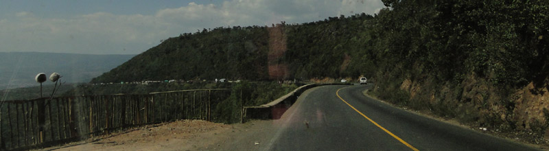
The road is still good until Narok, and even
further. At 7 PM we’re smiling thinking we’re going to reach our camp
just at the last minutes of daylight, but it is then, in a place called
Maji Moto, where the tarmac ends, without any previous sign, and gets
us to our well known hell.
A massive block of hard mud with a waving surface
as endless as the straight we have in front of us, forced us to drive
at 10 Km/h and suffering, even at that speed, as the night is closing
around us. This is the loneliest place in the world and the cars to and
from Narok are not taking this road, but go somewhere through the
savanna and we can only see their lights and dream we could take the
same way.
GPS is not lying to us when is showing a long way to our goal.
But it is long because we’re moving extremely slow over it. It is
completely dark when we see some maasai teenagers on motorbikes and, a
few minutes later, nothing at all.
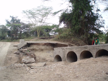
We pass though places where the road confuses in a sea of mud and
does the way more complicated. Our GPS keeps helping here. We pass
through some bridges over dry streams, each one is more spoiled than
the previous one, until we find one which floor we cannot see in the
shadow of the car lights. Eva doesn’t want I leave the car, but I must
check the bridge is ok. And standing out of the car, at the beginning
of the bridge, I can confirm there is no floor. So what now? I wonder
how to going on and those thoughts with the two of us sleeping in the
car are coming again. I move the car in a way its lights can show me
more of the place and I can see a way beside the bridge done by the
cars, going down to the bed of the river and then up again to the road.
The road goes on and on forever and as we can see how the hours are
falling quicker than kilometers, the vision about sleeping at car is
still there. I’m calling since time ago to the camp phone number in my
printed voucher and nobody is answering.
The worst
situation I can think of is reaching Maasai Mara gate and asking to the
ranger in there for help, but there is still a long way for it. The
darkness is so intense I think we can pass along the camp and miss it.
I’m recalling they have a time for electricity coming from a generator,
and later than 10 PM I know there is no going to be lights on it.
We try to cheering up with any little thing: the light on the top of an
antenna, a part of the road looking better… but when we reach
Oloolaimutia, the town giving name to the reserve’s gate, I think we’ve
left the camp behind. The entire town is in darkness, but when I stop
in front of a bunch of signs to read them we feel so happy when one of
them is pointing to “Rhino tourist Camp”. It says it is 2 Km deeper in
the town and has a phone number, different than the one I’ve been
calling to. We get immediate answer when calling to this one.
I still will need to call to that number some times more to find
the place as, in a point with three different roads with three
different signs pointing to three different camps, none of them is the
one we’re looking for. We still will drive for a while through that
area where is so difficult to know what is a way for a car or what is
not. When we arrive we must use the car horn and give the phone to the
boy who appears. He receives some indications from the man at phone for
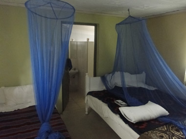
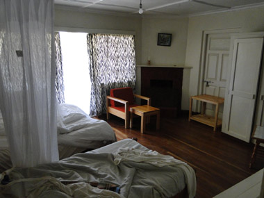
starting the generator and taking us to our room, with real walls. We
cannot get dinner, but we do get a bed. For tomorrow we will stay at
camp and rest. We could do a short tour but, overall, rest.
 The thing is we’ve got the
wrong way because at Mai Mahiu, the town just down in the valley, we’ve
gone on to the Old Naivasha road instead of turning to Narok road.
The thing is we’ve got the
wrong way because at Mai Mahiu, the town just down in the valley, we’ve
gone on to the Old Naivasha road instead of turning to Narok road.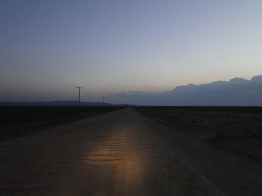
 We pass though places where the road confuses in a sea of mud and
does the way more complicated. Our GPS keeps helping here. We pass
through some bridges over dry streams, each one is more spoiled than
the previous one, until we find one which floor we cannot see in the
shadow of the car lights. Eva doesn’t want I leave the car, but I must
check the bridge is ok. And standing out of the car, at the beginning
of the bridge, I can confirm there is no floor. So what now? I wonder
how to going on and those thoughts with the two of us sleeping in the
car are coming again. I move the car in a way its lights can show me
more of the place and I can see a way beside the bridge done by the
cars, going down to the bed of the river and then up again to the road.
We pass though places where the road confuses in a sea of mud and
does the way more complicated. Our GPS keeps helping here. We pass
through some bridges over dry streams, each one is more spoiled than
the previous one, until we find one which floor we cannot see in the
shadow of the car lights. Eva doesn’t want I leave the car, but I must
check the bridge is ok. And standing out of the car, at the beginning
of the bridge, I can confirm there is no floor. So what now? I wonder
how to going on and those thoughts with the two of us sleeping in the
car are coming again. I move the car in a way its lights can show me
more of the place and I can see a way beside the bridge done by the
cars, going down to the bed of the river and then up again to the road.