|
|
Day
15
(September 22, 2012) The Catlins
Before
We would start from the point we end the previous
day
directly to the region known as “The Catlins”: New Zealand’s wildest
coast.
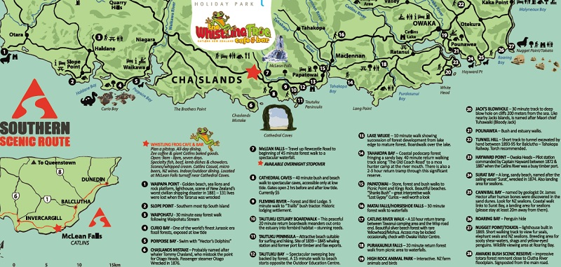
There are a lot of things to see there, which are
explained on this map of that area:
Our highlights will be:
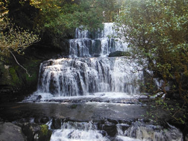
- The three waterfalls: McLean, Matai and
Purakaunui
- Curio Bay: A petrified forest from the Jurassic,
where you can still see the trees turned into stone now.
- Nugget Point: Cliffs, a lighthouse and wonderful
views.
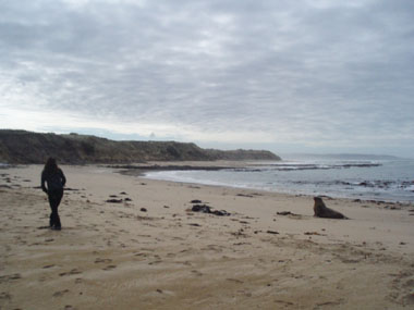
- Cannibal Bay: Sea lions and seals colony.
After that we would follow the route to Dunedin, where we could walk
around looking the Scottish architecture of its main buildings.
It would be about 270 Km for this day, which
should be covered in 3 hours and 40 minutes
|
After
We leave the Holyday Park with no rush as the
timing is
set by the tide for one of the main visits today. Our idea for today is
driving the two hundred something kilometers of distance to Dunedin
through a scenic route in a region called “The Catlins”, with multiple
short stops in our way. Today could be our last chance for seeing the
animals we haven’t been able of see before.
In order of doing that, we drive across Invercangill city following the
indications from the man in Holyday Park’s desk to take the scenic
route, which we’re not going to leave until Dunedin.
We‘re going to spend today in the area in the map at the beginning of
this page, from left to right, and therefore our first stop is
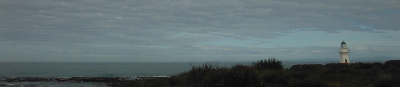
precisely the number 1 in there: Waipapa point. Here we’re expecting to
see sea lions and a lighthouse. The last kilometers of the road to this
point is a gravel one, which is not nice considering motorhome’s
insurances use to exclude anything on this kind of roads. As our
windscreens are not included anyway, we decide to spread ourselves to
leave more distance between each other in order of avoiding any chance
of being hit by a little stone thrown by the vehicle in front.
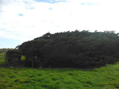
Once in Waipapa Point, the lighthouse is obviously here, but when we’re
looking at the big beach it is empty of animals. Somehow, when looking
to the part with rocks, just in front of the lighthouse, we can see one
lonely sea lion, lying on the beach. In our way to there we can see
several of these sorts of horizontal trees I mentioned yesterday, grown
like this because of the strong wind.
When we
arrive, the sea lion must feel like Brangelina, constantly chased by
people wanting a photo with it. There are some warnings before the
beach with advices about approaching to these animals as they can be
feel threatened by us and attack and, as they don’t seem like they
could, they’re able of running 20 Km/h fast chasing you. Another good
advice is never standing between the sea lion and the sea as it always
must defense its way to the water. We are posing closer and closer of
it, with all the respect, until our girl seems to reach the limit, as
the sea lion stands and roars strongly as per making her to run away
from it.
After a long while we come back to our
motorhomes, leaving the sea lion at its business, which basically means
sleep.
We take the road to Curio Bay this time. The
tide forecast points to be low enough by 11 AM for visiting the fossil
Jurassic forest. We’re in map’s point 4.
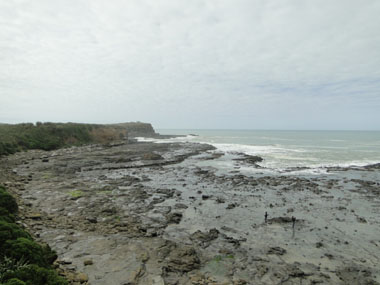
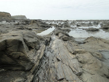
Once in
Curio Bay we can check the tide going lower and has already uncover the
irregular area which can look as a muddy surface but, it is wonderful
in a closer look. Everything is stone, but they were trees long time
ago. The mounds can be seen in the pictures are actually the stumps
from those trees and you can see the rings on them. Lines at floor are
the trunks and the wood grain can be seen so clear as per one need to
touch to verify, again, they’re really a rock. This is unique in the
world, although when reading about fossils, it is easy to think about
shells or animal bones, and there is none of those here.
 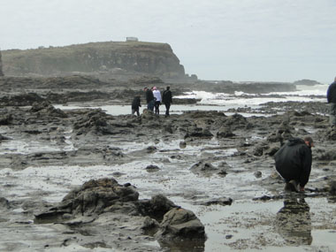
We spread around the area to explore the floor looking fascinated this
wonder and avoiding the sea water puddles. I’m trying to get into
pictures the reality of this place, but it is very difficult.
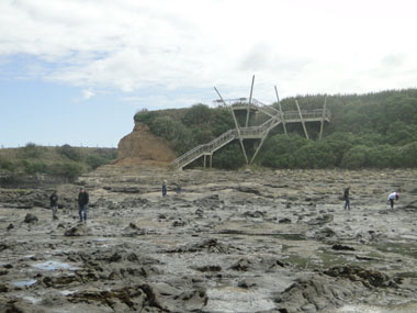
When we’re done we take the vehicles, but just for a very
short
ride to the highest point, marked at map as number 5, where there are
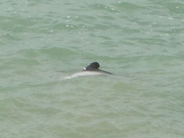
stunning views of Purpose Bay and the Curio Bay we’ve just left, and even
this is a place where you can see Hector dolphins, which we can really
do.
Obviously, dolphins are not jumping showing
completely and waving to the camera, instead we can only see their
backs over sea surface. Hector dolphins are smaller than the common
ones and are easily identified because they’re wearing two colors: a
clear grey and a dark grey.
It seems today can
finally be the animal’s day, although we can see just a single animal
by specie. Next stop, once again at road, means a rest in animals as
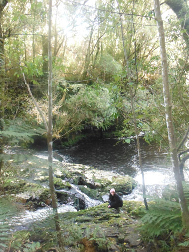
we’re going to the first of the falls: McLean Falls.
When we reach the Holyday Park in the junction, there is still some
more kilometers over a gravel road to get the parking area with toilets
and the start of a path taking to the falls. It’s shocking that, as
well as in Spain you cannot find paper in the toilet from a bar, in
this country it is never empty even in so isolated places like this.
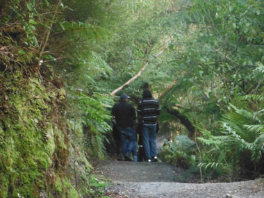
A sign in the start of the path announces it is 30 minutes long, and we
do it through a beautiful and dense jungle with ferns.
We pay attention to the river at our left when we start hearing the big
noise, but we find a small falls first and a short fall of water after
it. These falls are finally not that spectacular. But then some of us
find out there is still path going up and when they reach the end we’re
called in a way it is clear for us there is still more to see.
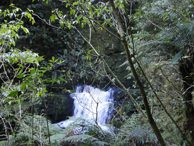 
And there is indeed: these are extraordinary falls, with different
levels with different heights. We get a deal with a group of teenagers
we find here for exchanging group photos: they do to us and we do to
them. When we leave, there are more visitors coming with tupperware in
their hands as they’re going to lunch in front of this nature show,
which seems a good idea.
When we’re back in our
motorhomes we know lunch time is around, but first we want to visit
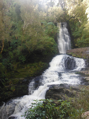
Purakaunui Falls. We drive directly to them from map’s point 7 to 18.
We find more gravel road in our way, it seems they’re quite usual
around this area. When we arrive we can see the parking is pretty full
of campervans. It is just in front of where the path to the falls
starts. This path is shorter than the MacLean’s one.
When we reach the wooden platform as lookout to the falls we need some
time to get some space in there as it is small and it is crowded. The
falls are beautiful but getting our pictures is not easy but, when we
can see there are still a big group of people coming we leave the place.
 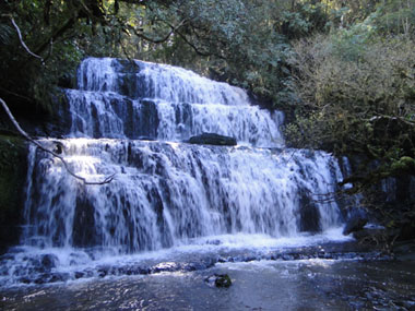
In the parking we can see a couple of coaches with teenagers which
explain the incoming flow of people to the falls. We’ve been so used to
the loneliness in our visits along this country we’re quite shocked by
this people affluence.
Now we’re going to Nugget
Point, which is our last stop for today (points 26 and 27 at map) and
we’re looking for a place to lunch in our way. We’ve got the food
cooked yesterday evening for a picnic today. After discarding a couple
of places because they were not sunny we stop in an idyllic picnic area
just in the intersection with Nugget Point road, along the beach.
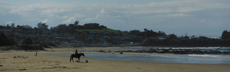
We eat here and then go for a walk to the big beach with just a couple
of persons in there: one with a dog and one riding a horse. We find a
lot of shells here. Some shocking as “giant” mussel ones –black, not
green -, small oysters and even some pieces of Paua, which we have
already purchased some entire shells.
Then is our
time to drive along the beach and over gravel, one more time, until
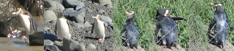
Nugget Point. We stop in a small parking area, just before the end of
the road, where is signed as a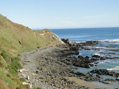 lookout place for a yellow eyed penguin
colony, a local specie. There is an observatory at the end of a path
from where you can watch how these animals return home, since 3 PM,
after a fish journey. It’s 4 PM now, so it seems to be a good time for
being lucky enough as per seeing someone. lookout place for a yellow eyed penguin
colony, a local specie. There is an observatory at the end of a path
from where you can watch how these animals return home, since 3 PM,
after a fish journey. It’s 4 PM now, so it seems to be a good time for
being lucky enough as per seeing someone.
At the
moment I can see the beach I see a penguin just coming out the sea and
we run to the observatory, where there are some other people. We’ve
been lucky and we can see how it goes to the rocks, walking clumsily,
as if it was carrying something heavy on the shoulders. Once in the
rocks it jumps, step by step, both legs together, in a very funny way.
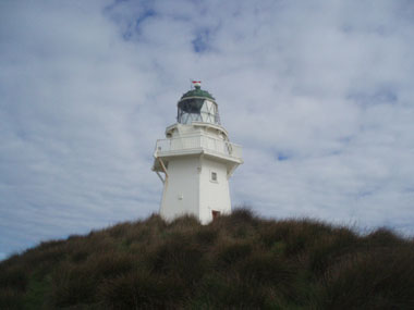
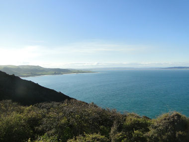
We can finish the road now until a much bigger parking area at the top
of the hill. From here, starts a path to the lighthouse one hour long
and another path to the view point five minutes long. We choose this
last one. There are no seals or sea lions or penguins or whales… but it
is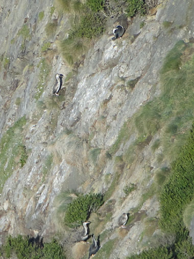 full of birds and wonderful views. full of birds and wonderful views.
This is our
last stop so we drive directly to Dunedin knowing we’re going to be
there early today. The chosen Holyday Park is a little before the city
center. We leave the motorhomes powered when is still daylight. It is
so late for going to the swimming pool today, so we are going to visit
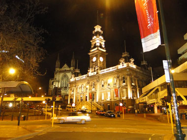
the city center for a walk and some drinks. One taxi is taking us to
the center, known as “The Octagon” because is the shape of the main
square, by 20$ for all 8.
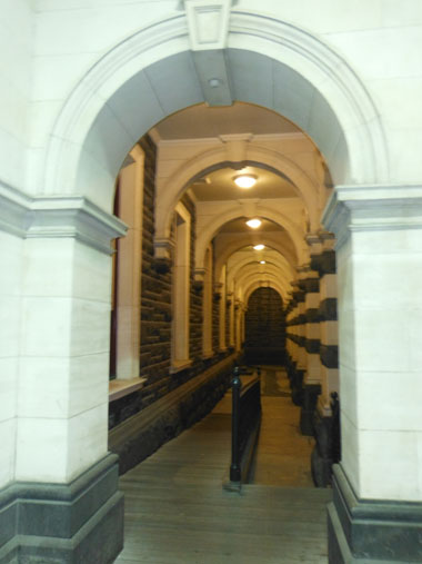
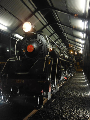
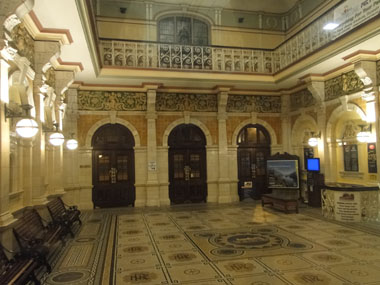
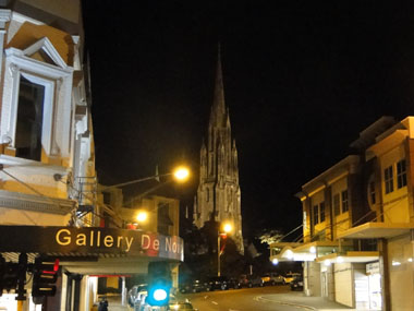
We walk around looking
for the most relevant buildings of this city, as the train station, and
come back to the square as we could check all the live is concentrated
at that point.
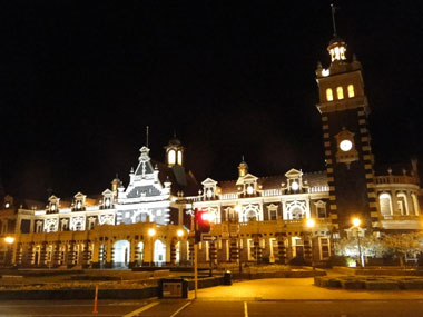 
I’ve read about the Scottish roots of this city
and the
pubs seem to point to that direction. There are a lot of them here and
we just choose one of the most crowded ones for taking something in
their tables outside.
When it is time to leave, the
same taxi, which was in the Octagon, returns us back to our motorhomes
by the same rate. Tomorrow, at last, we don’t have to leave early.
We’ve got a confirmation from the woman at des of the Holyday Park the
Albatross Reserve we wanted to visit is closed, though.
|
|
|
|